Inspired by the dynamic sites where fresh and ocean waters intermix, Brackish Water Los Angeles looks at the unique environments formed by the collision of water courses in the region, past and present. The exhibition is housed on the CSU Dominguez Hills campus in South Los Angeles, where local rivers have been transformed into concrete channels, and where industrial contamination and ecological racism have plagued surrounding communities for generations. Artifacts and artworks trace the intersections where ecology, culture, and community meet and uncover the complex ecosystems, infrastructures, and politics that both create and destroy brackish water habitats. Catherine Opie’s Freeways series draws parallels between the rivers and freeway systems as arteries of the region. Emma Robbins’s LA River Paper—made from materials the artist salvaged from the concrete river channel—demonstrates that the compromised urban waterway can still be useful and beautiful. Historic maps and images trace the river’s course and appearance pre-channelization, inviting visitors to imagine new possibilities for our landscape.
Brackish Water Los Angeles Higher Education Curricular Resource
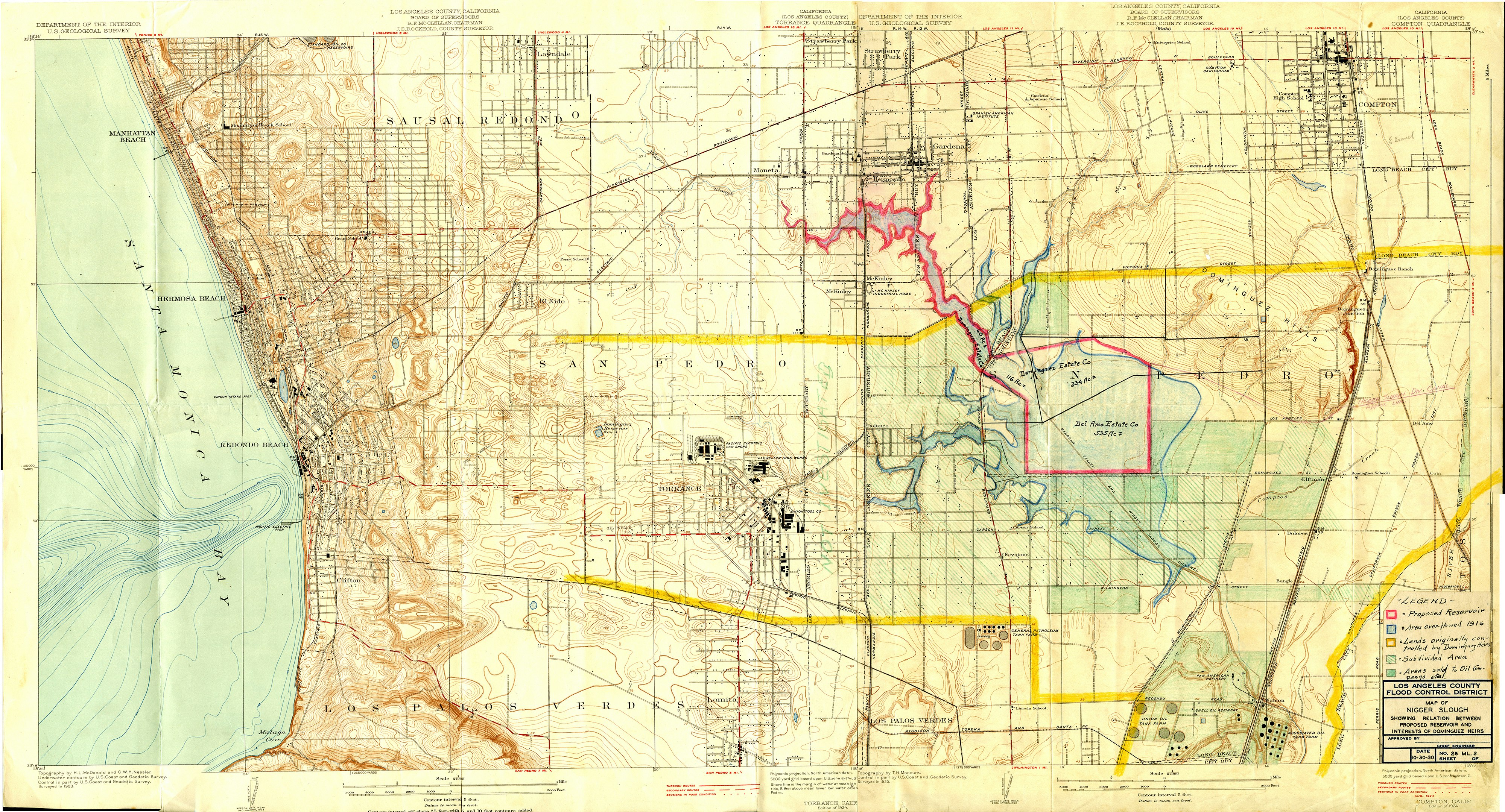
"South Bay," 1918. Topographic map of South Bay area, created and marked by Los Angeles Flood Control District. Map shows impact on Dominguez properties. Reservoir proposed to help prevent recurring flooding of standing slough during heavy rains. Courtesy of the Gerth Archives and Special Collections. University Library. California State University, Dominguez Hills.


CSU Dominguez Hills University Art Gallery
1000 East Victoria Street, Carson
MON-FRI:10am-5pm
SAT:12-5pm
SUN:CLOSED
Campus Map
Cal State Dominguez Hills
